Finding addresses is now easier. Google Maps app brings a different dimension to our lives with augmented reality.
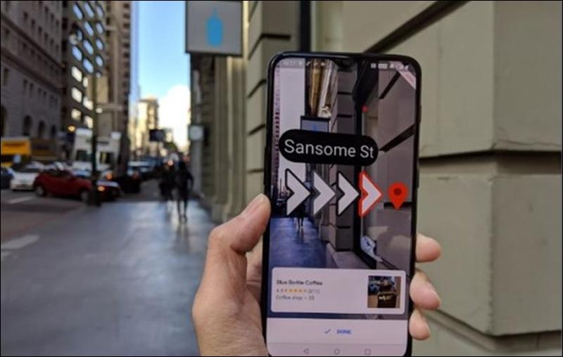
Google Maps has launched an augmented reality (AR) application that will direct people to their destination with pointers added to the real world live from the phone’s camera. Google was the first company to enable this feature for pedestrians.
In the last race in the industry, Apple filed a patent application on the same subject. But Google stepped forward in this area.
What is Augmented Reality (AR)?
It is called superimposing virtual objects on real images by using the object recognition feature of the devices. To benefit from this technology; you need internet access in your environment and devices that define augmented reality (smart glasses, smartphone or tablet). In addition, one of the applications defined on Augmented Reality must be installed on this device. After these conditions are met; When you define the image designed for Augmented Reality with the application on your device, your device perceives the image and you see a new image.
Visits: 73