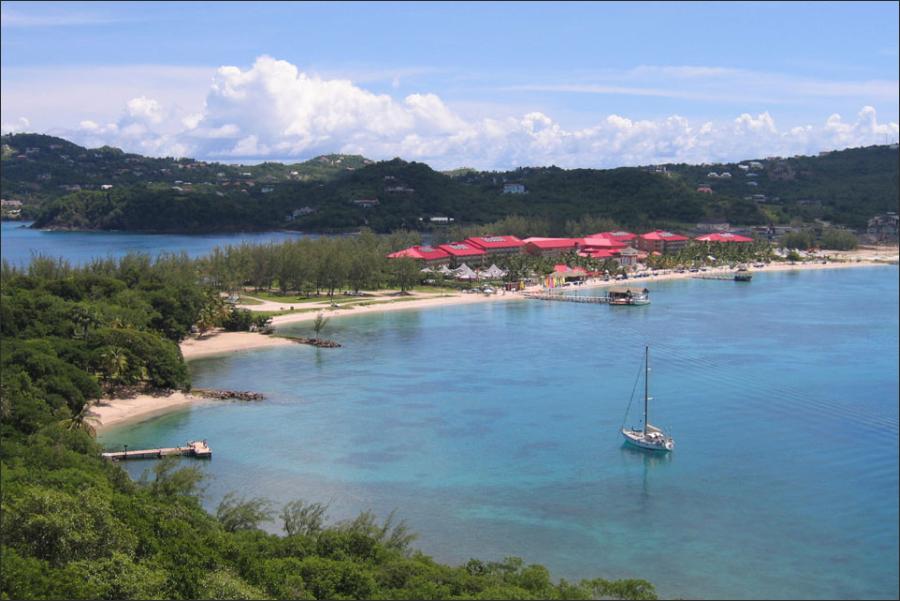
The Leeward Islands earned their name because they lie in the lee of the wind: the prevailing trade winds are blowing towards them from the east north east. They are situated near the meeting point of the Caribbean sea and the Atlantic Ocean. Although they are closely clustered they have had diverging histories of occupation and colonization, and some are still a part of the overseas territories of European nations.
From north to south the main islands are Anguilla, St Martin, Barbuda, St Kitts & Nevis, Antigua and Montserrat, together with smaller islands including St Barthelemy and Saba. Many Caribbean cruises combine multiple stops at these islands on one itinerary. They should not be confused with the Society Islands of French Polynesia, which are also sometimes referred to as Leeward Islands.
The Leeward Islands Colony consists of two main clusters of islands separated from one another by the 30-mile-wide Anegada Passage. Northwest of the passage lie the British Virgin Islands, comprising about 32 islands and rocks. Southeast of the passage the three presidencies of Antigua, St. Christopher and Nevis (with their dependency Anguilla), and Montserrat form a fairly compact group, except for Anguilla, lying about 55 miles north of St. Christopher, beyond intervening French and Dutch islands. The small, rocky Sombrero, some 35 miles northeast of Anguilla, belongs to the Virgin Islands presidency, from which, however, it is separated by Anegada Passage.
The Virgin Islands are of the same general geological composition as the Greater Antilles: a foundation of ancient crystalline rock has been deeply overlaid with conglomerates and clays, having an outer mantle of marine limestones and fringed with coral reefs. Tortola and Virgin Gorda, two of the three largest of the British islands of the group, are rugged, barren mountain crests (Tortola rising to 1780 feet, Virgin Gorda to 1370), poorly watered and largely rough waste land. Anegada, at the extreme northeast corner of the group, is very low, with no elevation above 30 feet.
The Lesser Antilles from Anegada Passage to the passage between Grenada and Trinidad consist primarily of a curving line of high volcanic islands. In the Leeward Islands northward from Guadeloupe, this line is bordered on the outer, or Atlantic, side by more or less scattered groups of lower islands. Both the inner and the outer islands rest on the same anciept volcanic basement. On the outer islands, the basement is deeply overlaid with white calcareous rocks, mostly limestones, but on the inner chain these deposits have been obliterated by subsequent volcanic eruptions or had already been eroded away before the eruptions took place.
The inner volcanic islands are remarkably alike: heaps of basalt or crumbling tuffs that weather into deep, rich black soil. Although much eroded, the islands north of Montserrat exhibit characteristic cone-shaped forms, and all have craters now long extinct. St. Christopher is a chain of jagged craters culminating in Mt. Misery (4330 feet). Nevis and the Dutch islands of Saba and St. Eustatius are essentially single cones.
The cone on Nevis rises symmetrically to 3596 feet and is so precipitous that all cultivation must be done with the spade, except on the narrow coastal plain. Montserrat, on the other hand, does not have the characteristic cone shape but is a rugged, deeply ravined, and heavily wooded mass of old volcanic rock (maximum elevation about 3000 feet), with only sulphur vents and small extinct craters as evidence of its former volcanic activity.
Of the outer calcareous islands, Anguilla and Barbuda are low and flat. While the rocks of Barbuda are composed entirely of shell, a large part of Anguilla is strewn with coral heads and boulders. Most of Barbuda is little more than 5 feet above the sea, but on its east side a terraced tableland rises to 205 feet. There are no streams or springs on either island; the soil of both is thin; and both have a cover of low scrub, although Barbuda supports a few good-sized trees.
Like Guadeloupe, Antigua, the largest island of the British Leeward Islands Colony, belongs partly to the calcareous and partly to the volcanic group. A dissected limestone plateau 100 to 200 feet high in the northeast is separated by a central plain from a small, rugged, wooded massif of volcanic tuffs rising to 1330 feet in the southwest. The result is a variety of soils not found on any of the other islands of the Leeward Islands Colony — fertile volcanic soils in the southwest, heavy clayey soils on the plain, and highly calcareous soils in the northeast.
The climate of all the islands of the British Leeward Islands Colony is delightful from the end of November to the beginning of May, when the trade winds begin to fall and the hot season sets in. Detailed climatic data are available only for St. John’s, Basseterre, and Plymouth. 4 Nevis may be assumed to have much the same climate as the near-by islands of St. Christopher and Montserrat. Anguilla is reported as having an annual temperature range between 75° F. and 85° F.
All of the islands are subject to frequent droughts, and the rainfall in Anguilla is particularly irregular. On the Virgin Islands the average rainfall is about 55 inches, and the temperature range is about the same as on Antigua, with the temperature rarely rising above 90° F. and often falling below 65° F. All the islands are in the path of the West Indian hurricanes, but really disastrous occurrences are not frequent.
