The Bahama Islands consist of about 20 inhabited islands and more than 3000 islets, cays, and rocks. The land area of the 19 principal islands, of which Andros ( 1600 sq. mi.) is the largest, is about 4375 square miles. The Turks and Caicos Islands, which form the southeast end of the archipelago, were formerly administered as a part of the Bahama Colony but are now governed as dependencies of Jamaica.
Geologically and physiographically the Bahamas are related to Florida and the Florida keys. They are formed largely of minute particles of calcareous sand derived from shells. Originally piled up by wind action into low, rounded hills and ridges on a shallow marine platform, these sands have been consolidated by exposure into rock that on the surface is as hard as flint but underneath is soft enough to be easily sawed into building blocks. The hills and ridges nowhere exceed 100 to 200 feet in height except on Cat Island, where they rise to nearly 400 feet.
One of the most arresting aspects of the islands is the almost complete lack of normal stream-erosion features. Instead, there are typical karst forms produced by the action of rain water on highly soluble rock — potholes, boiling holes, peculiar cylindrical “banana holes” reaching to depths as great as 40 feet, and cavities and caverns, many of which have subterranean connection with the sea. Because of the lack of streams or other fresh-water bodies, man and beast depend largely on rain water collected in cisterns, although a few natural and dug wells also supply drinkable water.
As the result of a geologically recent subsidence estimated at about 300 feet, much of the far more extensive land surface of former times now consists of shallow submerged banks above which rise many coral heads and reefs. The barrier reefs along the exposed eastern border of the outer rim of islands are so extensive as to make this shore almost inaccessible to shipping. Numerous channels separate the islands into groups. Although some are of sufficient depth to afford through passage to ships of deep draft and the principal passages are well lighted, most of the channels are difficult of navigation.
CLIMATE
The Bahamas have a typically subtropical oceanic climate. The mean annual temperature at Nassau is 77.2° F., with the mean temperature for the warmest month (August) 83° F. and for the coolest month (January) 71-7° F. Because of the warming effect of the Gulf Stream, the islands have an advantage over near-by Florida, which occasionally suffers damaging frosts; the lowest temperature recorded for the Bahamas is 51.5° F.. The average annual rainfall is about 46 inches, but in 1938 only 28.91 inches were recorded on New Providence. The rainy season is from June to October, with little rain during the rest of the year. West Indian hurricanes of destructive force visit the islands on an average of about five times in every ten years.
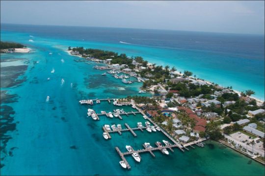
From the sea the islands appear as low stretches of green bordered by bands of white beach or surf. Where there is a cover of soil on the rocks it is usually very fertile, although thin. In places, as on New Providence, such areas are frequently overgrown with pines like the pines of the Florida coast and are called “pine barrens.” Only a few of the islands are forested. Andros and the Abaco Islands, however, have good growths of mahogany, lignum vitae, mastic, ironwood, and bulletwood. The natural vegetation of most of the islands is a stunted growth, with mangrove predominating. On the flat lands there are some savana areas, but low thickets are of more frequent occurrence.


